More Timezone Lookup (loading and saving data)
… in which we explore how to write internal Racket data structures to disk and read them back, and use these features to improve load times for the GeoJSON data, so the program does not have to spend 20 seconds in the initialization step.
In the previous blog post we looked at how to perform a geo-lookup and determine the time zone corresponding to some GPS coordinates. Various improvements were done over the initial search algorithm, and, in the end, the average time to perform the timezone lookup was reduced substantially.
So far, two aspects of the lookup function have been ignored: it takes a long time to load and prepare the lookup data, about 20 seconds, and the size of the GeoJSON file containing the timezone boundaries is about 129Mb which is very large. This large initialization time means that there is still a large cost for using the lookup function in an application which needs to do just a few lookups and the large GeoJSON file has two further implications: (1) the size of the package on disk is too big and (2) memory usage of the application is also large, since all that data has to be loaded in the program memory.
In this blog post we’ll look at how to improve the load times: we’ll try to use the read and write built-in Racket functions to save the prepared features to disk once and read them when using the lookup program, but it turns out that these functions are slower than just reading the GeoJSON data directly. Next, we’ll try the Fast-Load Serialization functions and these will provide significantly faster load times. After that, we’ll explore how to avoid loading the entire data set into memory, and we’ll do that by saving the data for each timezone in a separate file and only load them when needed. Finally we’ll try to reduce the space used on disk by compressing the data files and decompressing them in memory.
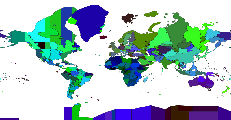
World TimeZones
Short refresher
The setup process for the timezone lookup was split in two functions: load-geojson loads the GeoJSON timezone data, and just calls load-json, while the prepare-features function constructs bounding boxes and converts polygons from the GeoJSON lists to vectors, for faster lookups. See the previous blog post for details of these functions. Their running times are shown below:
| function | total calls | total time (ms) |
| load-geojson | 1 | 9791.16 |
| prepare-features | 1 | 8290.5 |
Since the time zone data does not change very often, we could just save the result of prepare-features and load that at startup, saving the time to prepare the feature data structures each run. We can split the timezone lookup process in two: a tzpack function will load the GeoJSON timezone data, prepare the data such that it is convenient to use by the tzlookup, than save it to disk. The tzlookup package would load this data from disk and use it for lookups. We would only need to run tzpack when a new GeoJSON dataset is released, so this would save time.
read and write
How to save the data? Well, Racket already provides the write function to write an internal data structure to an output stream and the corresponding read function to read it back. There are some limitations on what data can be serialized this way, but this includes structures, vectors and lists, which is what we use, so these functions are adequate for our purpose. The only change is that we have to tag our structures with the #:prefab keyword, but this does not affect the rest of the code:
We can than load the GeoJSON, prepare the features and save it all to disk, in the “tzdata.dat” file, in only a few lines of code:
1 2 3 4 5 6 7 |
(define features (let ([tzdata (load-geojson "./data/combined.json" #:verbose #t)]) (prepare-features tzdata))) (call-with-output-file "./tzdata.dat" (lambda (out) (write features out)) #:exists 'replace) |
Running the above program will require the load-geojson, prepare-features and related functions presented in the previous blog post, and will produce a data file which is 117Mb in size, which is smaller than the original 129Mb GeoJSON file, but not by much, in both cases we could compress the resulting files, reducing their size on disk, but they would have to be stored uncompressed in memory anyway, so these numbers are also indicative of the approximate memory usage of the program.
The lookup program will have to load this data, which in this case it involves calling read to load the data into the features global variable. The rest of the program will remain unchanged:
1 2 3 4 |
(define (load-data path) (call-with-input-file path read)) (define features (load-data "./tzdata.dat")) |
How does this compare? Well, the running times are below and a few things are expected: load-geojson and prepare-features are no longer called, since they were replaced by load-data and the rest of the running times are about the same, since the tz-lookup operates on the same data structures. Unfortunately, loading the data takes 38 seconds, which is much longer than loading the GeoJSON and preparing the features each time, so using write and read to write a complex data structure to disk and read it back is easy, but the result is not very fast:
| function | total calls | total time (ms) | min (ms) | max (ms) | average (ms) |
| load-data | 1 | 37947.24 | 37947.24 | 37947.24 | 37947.24 |
| tz-lookup | 1038 | 30403.9 | 1.06 | 247.86 | 29.29 |
| feature-winding-number | 442188 | 30208.83 | 0 | 141.35 | 0.07 |
| shape-winding-number | 1223802 | 29746.79 | 0 | 141.34 | 0.02 |
| polygon-winding-number | 1497797 | 29169.28 | 0 | 141.34 | 0.02 |
| polygon-winding-number-internal | 1706 | 28649.1 | 0 | 141.33 | 16.79 |
| subtended-angle | 55104870 | 10463.29 | 0 | 2.88 | 0.00019 |
Fast-Load Serialization
The output produced by write is indented to be somewhat human readable and this might contribute to it being slow. Racket also provides some serialization/deserialization routines which produce binary data and promise to be faster. They are part of the racket/fasl library and using them is as simple as replacing write with s-exp->fasl and read with fasl->s-exp. The tzpack program becomes:
1 2 3 4 5 6 7 8 9 |
(require racket/fasl) (define features (let ([tzdata (load-geojson "./data/combined.json" #:verbose #t)]) (prepare-features tzdata))) (call-with-output-file "./tzdata.dat" (lambda (out) (s-exp->fasl features out)) #:exists 'replace) |
And loading the data in the lookup program becomes:
1 2 3 4 |
(define (load-data path) (call-with-input-file path fasl->s-exp)) (define features (load-data "./tzdata.dat")) |
Unfortunately, fast-load serialization does not support floating point vectors, but since using flvectors turned out to be a performance loss, I reverted the code to use plain vectors.
Using s-exp->fasl results in a 104Mb data file, which is smaller than the one created by write, which was 117Mb. Loading the data is also faster, at 1.2 seconds, which is about 30 times faster than read and about 15 times faster than the loading the GeoJSON itself and preparing the data set:
| function | total calls | total time (ms) | min (ms) | max (ms) | average (ms) |
| load-data | 1 | 1217.51 | 1217.51 | 1217.51 | 1217.51 |
| tz-lookup | 1038 | 26628.92 | 1.01 | 164.12 | 25.65 |
| feature-winding-number | 442188 | 26459.86 | 0 | 89.83 | 0.06 |
| shape-winding-number | 1223802 | 26048.1 | 0 | 89.82 | 0.02 |
| polygon-winding-number | 1497797 | 25529.97 | 0 | 89.81 | 0.02 |
| polygon-winding-number-internal | 1706 | 25326.43 | 0 | 89.81 | 14.85 |
| subtended-angle | 55104870 | 9462.48 | 0 | 3.82 | 0.00017 |
Runtime memory use
Each time we use the timezone lookup function, we must load the entire data set, which is about 100Mb on disk. How much memory does it use? Well, the entire data set has 5′728′474 GPS points, and since each latitude/longitude coordinate is represented as a pair of double-precision floating point number, which are 8 bytes each, just storing the points will take up 87 Mb of memory, with the actual memory use being higher since there is some overhead for the additional data structures such as bounding boxes. It looks like the size of the serialized data is a pretty good indication of the memory used for time zone lookup.
While the 1.2 seconds it takes to read the data might be sufficient, the high memory use will probably not be acceptable for an application which needs to do a lookup occasionally.
How can we reduce memory use? The basic idea is to only load the data we actually need: when we introduced bounding boxes, it meant that entire polygons were skipped by polygon-winding-number and perhaps we can avoid loading these polygons altogether.
Unfortunately, Racket does not provide direct facilities for only reading data that we need, both fasl->s-exp and read will read the entire data set. We can address this limitation by clever use of these functions: The features variable stores a list of feature structures which are inspected one-by-one by tz-lookup, but we can change that so that (1) each feature structure is saved in a separate file and (2) having an index with the bounding boxes and the features to check.
Saving individual features, means that we’ll need to call s-exp->fasl on each individual feature and save it into a separate file. File names are constructed from the actual time zone names by replacing the "/" (which is invalid in a file name) with a "+" sign:
1 2 3 4 5 6 7 8 9 10 11 12 13 14 |
(define (save-data data file-name) (call-with-output-file file-name (lambda (out) (s-exp->fasl feature out)) #:exists 'replace)) (define features (let ([tzdata (load-geojson "./data/combined.json" #:verbose #t)]) (prepare-features tzdata))) (make-directory* "./pack") (for ([feature (in-list features)]) (define file-name (format "pack/~a.dat" (string-replace (feature-name feature) "/" "+"))) (save-data feature file-name)) |
To build the index, we’ll need to scan all the features and find the polygon bounding box for each shape outline, and produce a list with the feature name and the bounding box itself. The index itself is saved into a separate file, “index.dat”, also using s-exp->fasl:
While the total data size is still the same, each timezone definition is in its own separate file, which means that it can be loaded individuality, while the index file is only 56Kb in size.
The lookup functionality will have to change, since we changed the the way we store the data: we will load the index first, and just prepare a hash table for the features that will be loaded. Initially, the hash will be empty:
The tz-lookup function will have to scan the index first, and only check features for which the location to be tested is inside the bounding box:
1 2 3 4 5 6 7 8 9 10 11 12 |
(define (tz-lookup lat lon) (define candidates (for/fold ([result '()]) ([entry (in-list index)]) (match-define (cons name bbox) entry) (if (inside-bbox? bbox lat lon) (let ((wn (feature-winding-number name lat lon))) (cons (list name wn) result)) result))) ;; filtering and selecting candidates remains the same ) |
And, finally, the feature-winding-number needs to be updated to accept a time zone name (instead of the feature structure itself), lookup the feature and load it if needed. feature-winding-number-internal contains the old body, which evaluates the actual feature struct:
1 2 3 4 5 6 7 |
(define (feature-winding-number feature-name lat lon) (define feature (hash-ref features feature-name #f)) (unless feature (define file-name (format "pack/~a.dat" (string-replace feature-name "/" "+"))) (set! feature (load-data file-name)) (hash-set! features feature-name feature)) (feature-winding-number-internal feature (exact->inexact lat) (exact->inexact lon))) |
And below are the performance results for the updated code. load-data is now called multiple times, to load both the index and the features, as they are needed, however, on average this call only takes 2.35 milliseconds now, since it has to load much less data each time. The time for the tz-lookup call went up by 5 milliseconds, since the function may have to load some timezone data if it is not already in the cache, but the average time is still under 30 milliseconds, which is pretty good, with even the maximum time of 234 milliseconds probably being acceptable for many applications — this time corresponds to a call that had to load one or more data files.
| function | total calls | total time (ms) | min (ms) | max (ms) | average (ms) |
| load-data | 234 | 549.56 | 0.07 | 25.34 | 2.35 |
| tz-lookup | 1038 | 31114.38 | 0.04 | 234.84 | 29.98 |
| feature-winding-number | 1706 | 31033.07 | 0 | 230.89 | 18.19 |
| feature-winding-number-internal | 1706 | 30466.94 | 0 | 230.89 | 17.86 |
| shape-winding-number | 6627 | 30460.42 | 0 | 230.89 | 4.6 |
| polygon-winding-number | 9534 | 30452.65 | 0 | 230.88 | 3.19 |
| polygon-winding-number-internal | 1724 | 30446.66 | 0 | 230.88 | 17.66 |
| subtended-angle | 55328096 | 11153.11 | 0 | 224.75 | 0.00020 |
Compressing the data files
The data files produced by s-exp->fasl are about 102Mb in size, and while this is smaller than the original 129Mb for the GeoJSON file, they are still a sizable chunk. A quick test, indicated that compressing these files using gzip would reduce their size to about 62Mb — this is still big, but it will save about 40Mb, which is worth doing since Racket has built-in file compression routines, and we can use them to compress the data as it is written out and decompress it as it is read in.
The compression is done using gzip-through-ports, which requires an input port and output port; the output port will be the file itself, and is provided by call-with-output-file, while the input port will be provided from a byte buffer using call-with-input-bytes. The byte buffer itself will be created by calling s-exp->fasl with an byte output buffer, via call-with-output-bytes.
1 2 3 4 5 6 7 8 9 10 11 |
(require file/gzip) (define (save-data data file-name) (define buffer (call-with-output-bytes (lambda (out) (s-exp->fasl data out)))) (call-with-output-file file-name (lambda (out) (call-with-input-bytes buffer (lambda (in) (gzip-through-ports in out file-name (current-milliseconds))))) #:exists 'replace)) |
To read the data, we’ll need to use gunzip-through-ports and perform all the steps in reverse:
1 2 3 4 5 6 7 8 9 10 |
(require file/gunzip) (define (load-data path) (define data (call-with-output-bytes (lambda (out) (call-with-input-file path (lambda (in) (gunzip-through-ports in out)))))) (call-with-input-bytes data fasl->s-exp)) |
These changes are isolated to the save-data and load-data functions only, nothing else needs to change, so it is a good disk space saving with a minimum of effort. How does the performance change? The full performance results re below, and we can see that the average time for load-data has gone up to 18 milliseconds from 2 milliseconds, since it now has to decompress the data. The time for tz-lookup has also gone up by 5 milliseconds on average, since it has to call a slower load-data for some of the lookups, but not for all of them. The price we paid for smaller disk usage was a higher lookup time.
| function | total calls | total time (ms) | min (ms) | max (ms) | average (ms) |
| load-data | 234 | 4304.51 | 0.13 | 270.68 | 18.4 |
| tz-lookup | 1038 | 35882.5 | 0.05 | 375.55 | 34.57 |
| feature-winding-number | 1706 | 35794.07 | 0.01 | 288.66 | 20.98 |
| feature-winding-number-internal | 1706 | 31472.95 | 0 | 127.34 | 18.45 |
| shape-winding-number | 6627 | 31465.5 | 0 | 127.32 | 4.75 |
| polygon-winding-number | 9534 | 31457.16 | 0 | 127.32 | 3.3 |
| polygon-winding-number-internal | 1724 | 31450.41 | 0 | 127.32 | 18.24 |
| subtended-angle | 55328096 | 11338.9 | 0 | 50.44 | 0.00020 |
Final Thoughts
Loading the GeoJSON files and preparing the data for use by the tz-lookup function took about 20 seconds, which meant that there was a large upfront “cost” of using the lookup function. First, we split the task into two programs: one which loads the GeoJSON file, packs it and saves the data to disk, and another program which loads the data and does the lookups. Since the GeoJSON data changes only a few times a year, the packed data will only rarely need to be updated and can be shipped with the package. Next, we reduced the startup time to a negligible amount by using Fast-Load Serialization and by splitting the data into separate files, but as a result of this, the lookup function is slightly slower since it now has to load the data as it is needed. Optimization is often about making trade-offs, but I believe that the slower lookup times are worth the benefit of a very fast initialization time, since the lookup is still only 34 milliseconds on average.
In the end the required disk space to store the data was about 62Mb which is still somewhat large, but since disks now have hundreds of gigabytes of disk space, perhaps not such a big issue. Still, this is an area of improvement. It is worth mentioning here that there are timezone lookup packages which use a much smaller amount of disk space, however, these packages trade off accuracy in non-populated areas and discard information when they store the data on disk — this trade-off might be a valid one when disk space is at a premium, but this blog post focused on maintaining full accuracy everywhere.
This and the previous blog post went through about 10 revisions of the timezone lookup programs, and the unit test suite that was written at the start proved itself very useful, as I could confidently make changes to the program, knowing that the program still performed its intended function, to resolve GPS coordinates to timezones.
Finally, the sources for the programs presented in this Blog Post are available here.